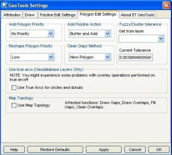
ET GeoTools is a set of tools for ArcGIS which purpose is to increase the editing productivity in ArcMap, give enhanced editing functionality to the ArcView users and enable them to create and maintain topologically correct datasets.
The tools are designed mainly for users with ArcView license, but will be asset for ArcEditor & ArcInfo license holders as well.
Highlights:
Productivity – performing editing tasks in a fast and efficient way
Identifying topology errors – draw nodes and duplicates for polyline layers, gaps and overlaps for polygon layers
Correcting topology errors – on shapefile and geodatabase layers
Adding new geometries and maintaining topological relationships between the features
Gives to ArcView users some editing tools standardly available to ArcEditor & ArcInfo license holders only – generalize, smooth, creating polygons from polylines, etc.
Offers usage of attribute update rules (including ranges – not available in any ArcGIS license) when splitting or merging polylines from shapefile or geodatabase layers
Allows capturing spatial data together with the attributes which significantly improves the performance of capturing data
Offers productive way of copying, editing and pasting attribute data.
Users with ArcView licenses can edit the attributes of simple SDE feature classes
COGO module - Traverse and Inverse with an ArcView license

ArcGIS Engine is a complete library of embeddable GIS components for developers.
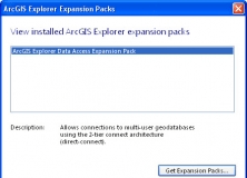
It expands the geodatabase functionality of the ArcGIS Explorer Desktop app.

It is a plug-in that provides interoperability between AutoCAD and ArcGIS.


Comments